
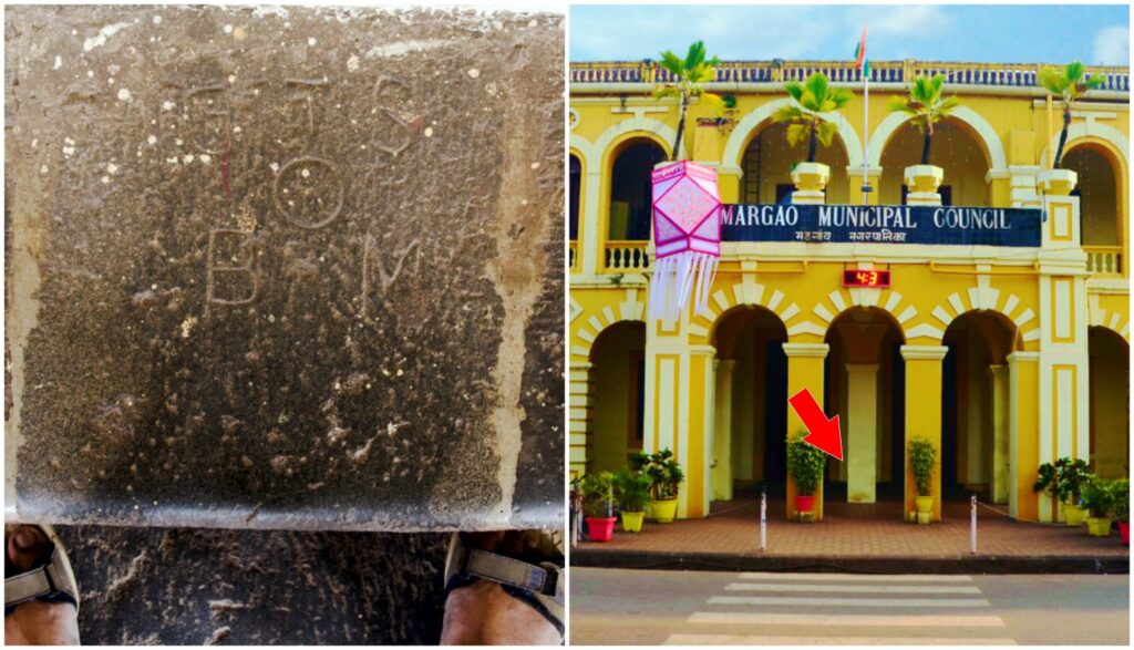
There are places where history announces itself loudly—and others where it lies quietly beneath your feet. In Margao, at the entrance of the Municipal building, a small, unassuming marker belongs to one of the greatest scientific undertakings of the 19th century: the Great Trigonometrical Survey (GTS).
Conceived under the East India Company, the survey set out to measure and map the Indian subcontinent with unprecedented precision. Using large-scale triangulation—an intricate network of interlinked triangles—it transformed a vast and varied landscape into a precise geographical framework. In the process, it advanced understanding of the Earth’s curvature and revealed the true scale of the Himalayas, including the peak that would later be named Mount Everest.
The survey began on 10 April 1802, when Colonel William Lambton measured the first baseline near Madras (present-day Chennai). From this carefully measured line grew a monumental project that would span nearly 70 years, stretching from Cape Comorin to the Himalayas—an arc often referred to as the “Great Arc.”
Carried forward by successors such as Sir George Everest, the survey achieved remarkable milestones. Using massive theodolites to measure precise angles, it calculated the heights of major peaks—including Peak XV (later Mount Everest), Kanchenjunga, and K2—with extraordinary accuracy. It also led to the development of the “Everest Spheroid,” a reference model used in mapping for over a century.
Beyond its scientific achievements, the GTS laid the foundation for the Survey of India’s detailed maps, which proved vital for planning railways, telegraph networks, and territorial boundaries. It also established enduring benchmarks—fixed reference points for elevation—that continue to underpin modern surveying in India.
And in Margao, at the entrance of the Municipal building, one such marker lies embedded in the steps. Easy to miss, it is a small, enduring trace of that grand ambition—a reminder that this town, too, was once a point in a vast geometric vision that sought to measure an entire nation with mathematical precision.